Quick answer
Understanding the classification of surveying is vital because it helps determine the right methods and tools for a specific project. Surveying is classified based on purpose (e.g., land, hydrographic, or engineering surveying), methods (e.g., plane or geodetic), and instruments used. Choosing the correct type ensures accuracy, efficiency, and cost-effectiveness. It also aids in meeting legal and regulatory standards. Misclassification can lead to errors, delays, and increased expenses.
In this article, we’ll break down the classification of surveying, explain why it’s essential, and how it impacts your projects. We’ll delve into the main types, their purposes, and the specific applications they serve. By the end, you’ll have a solid grasp of surveying classifications and how they can influence the accuracy and efficiency of your work.
What is Surveying?
Surveying is the process of measuring and mapping out the position, shape, and elevation of a piece of land. It’s used in construction, real estate, civil engineering, and even in navigation. But not all surveying is the same—different types of surveying are used for different purposes. So, why is it important to understand these classifications? Let’s find out.
Why is Understanding the Classification of Surveying Important?
Understanding the classification of surveying is vital because it helps you choose the right method for your project. Selecting the wrong type can lead to inaccurate data, delays, and increased costs. For example, using a topographic survey for boundary determination might give you misleading information. Knowing which type to use ensures precision, saves time, and reduces the risk of costly errors.
- Aligns Techniques with Goals: Ensures the right surveying method is used for specific projects.
- Enhances Accuracy: Improves precision in data collection and measurement.
- Saves Time and Resources: Avoids unnecessary steps and redundant work.
- Supports Decision-Making: Provides tailored data for better planning and execution.
- Improves Communication: Helps stakeholders understand and use survey data effectively.
- Ensures Compliance: Meets legal and regulatory requirements for specific surveys.
- Adapts to Technology: Guides the use of modern tools like drones and GPS.
- Boosts Efficiency: Streamlines processes for faster and more reliable outcomes.
Classification of Surveying:
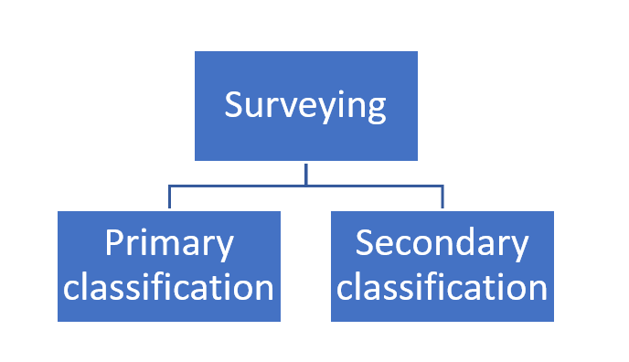
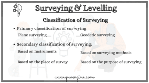
There are various types of surveying that are conducted in Civil engineering works. Those different types of surveying are mainly classified into two types of classification of surveying.
- The primary classification of surveying
- The Secondary classification of surveying

What Are the Main Classifications of Surveying?
Surveying is broadly classified into two main categories: Geodetic Surveying and Plane Surveying. Let’s explore each.
1. Geodetic Surveying: When Accuracy is Paramount
Geodetic Surveying involves measurements that consider the curvature of the Earth. This type of surveying is used for large-scale projects, like mapping continents or designing highways that stretch over vast distances. It’s crucial for projects where precision over long distances is required.
- Purpose: Used in large-scale projects where high precision is needed.
- Applications: Mapping national boundaries, designing intercontinental pipelines, and global positioning systems (GPS).
2. Plane Surveying: Simplicity Meets Efficiency
Plane Surveying assumes the Earth is flat, which simplifies calculations. It’s typically used for smaller projects, such as building a house or developing a small parcel of land. While it might not be as precise as geodetic surveying, it’s more than adequate for most projects.
- Purpose: Suitable for smaller projects with limited scope.
- Applications: Land subdivision, construction of buildings, and road alignment.

What Are the Sub-Classifications of Surveying?
Beyond the main categories, surveying is further classified based on the method used, the nature of the field, and the object being surveyed.
1. Based on Instruments Used: Traditional vs. Modern
- Chain Surveying: One of the simplest forms, using chains or tapes to measure distances. It’s mainly used for small, flat areas.
- Compass Surveying: Employs a magnetic compass for determining directions and is often used for preliminary surveys.
- Theodolite Surveying: Utilizes a theodolite to measure horizontal and vertical angles, suitable for more accurate work.
- GPS Surveying: Involves using satellites for highly accurate positioning, increasingly common in modern surveying.
2. Based on the Nature of the Field: Land, Marine, and Astronomical
- Land Surveying: The most common type, used for mapping and planning construction projects on land.
- Marine Surveying: Focuses on mapping bodies of water and is vital for navigation and marine construction.
- Astronomical Surveying: Involves measuring celestial bodies to determine time, latitude, and longitude.
3. Based on the Object Surveyed: Engineering, Archaeological, and Military
- Military Surveying: Essential for planning military operations, including the layout of bases and the positioning of troops.
- Engineering Surveying: Supports the planning and execution of civil engineering projects, including roads, bridges, and dams.
- Archaeological Surveying: Used to locate and map ancient sites, crucial for preserving historical artifacts.

What Tools and Technologies are Used in Modern Surveying?
Modern surveying has evolved significantly with the advent of new technologies. While traditional tools like chains and compasses are still in use, most surveyors now rely on advanced equipment like GPS, drones, and laser scanners. These tools increase accuracy, reduce time, and allow for surveying in challenging environments.
- Drones: Drones equipped with cameras and LiDAR sensors are revolutionizing surveying by providing detailed aerial views and data collection in inaccessible areas.
- Laser Scanners: These devices capture precise 3D models of the terrain, ideal for complex projects like tunnels and bridges.
- Total Stations: Combining the functions of a theodolite and electronic distance measurement, total stations are essential for accurate land surveying.
What Are the Advantages and Limitations of Each Surveying Type?
Each surveying type has its strengths and weaknesses. Understanding these can help you make the right choice for your project.
1. Geodetic Surveying
- Advantages: High precision over long distances, essential for large-scale projects.
- Limitations: Expensive and time-consuming, not suitable for small projects.
2. Plane Surveying
- Advantages: Simple, cost-effective, and sufficient for most small to medium-sized projects.
- Limitations: Not accurate for large distances where the Earth’s curvature needs to be considered.
3. Chain Surveying
- Advantages: Easy to use and inexpensive, good for small, flat areas.
- Limitations: Limited accuracy, not suitable for large or uneven terrains.
4. GPS Surveying
- Advantages: Highly accurate, fast, and suitable for large areas.
- Limitations: Requires clear skies and can be expensive.
What Are Some Common Mistakes in Surveying?
Surveying, while straightforward in theory, is prone to errors if not done carefully. Some common mistakes include:
- Incorrect Instrument Calibration: Even a slight error in calibration can lead to significant inaccuracies.
- Ignoring Environmental Factors: Failing to account for weather conditions, like temperature or wind, can affect measurements.
- Overlooking Legal Boundaries: Not verifying legal property boundaries can lead to disputes and costly legal battles.
Do’s and Don’ts in Surveying
Do’s
- Do Calibrate Instruments Regularly: Ensure all equipment is properly calibrated before starting a survey.
- Do Verify Data: Always double-check measurements to prevent errors.
- Do Consider Environmental Factors: Take into account the terrain, weather, and other environmental factors that might affect the survey.
Don’ts
- Don’t Rush the Process: Surveying requires precision; rushing can lead to mistakes.
- Don’t Ignore Legal Boundaries: Always ensure you are working within the correct property lines.
- Don’t Neglect Safety: Surveying often involves working in challenging environments—always prioritize safety.
FAQs
- What is the difference between geodetic and plane surveying?
- Geodetic surveying considers the Earth’s curvature, suitable for large-scale projects, while plane surveying assumes the Earth is flat, ideal for smaller projects.
- Why is GPS surveying becoming more popular?
- GPS surveying offers high accuracy and speed, making it ideal for large and complex projects.
- Can I use chain surveying for a large project?
- Chain surveying is best for small, flat areas. It’s not recommended for large projects due to its limited accuracy.
- What tools are essential for modern surveying?
- Essential tools include drones, laser scanners, GPS devices, and total stations for accuracy and efficiency.
- How do I choose the right type of surveying?
- Consider the project’s size, required accuracy, and budget when choosing the type of surveying.
- What happens if my survey is inaccurate?
- Inaccurate surveys can lead to construction errors, legal disputes, and increased costs.
- Is surveying necessary for all projects?
- Yes, surveying is crucial for ensuring accurate measurements and legal compliance in any construction project.
- How does the environment affect surveying?
- Environmental factors like weather and terrain can impact the accuracy of a survey, so they must be considered.
- What are the risks of not calibrating surveying instruments?
- Not calibrating instruments can lead to significant measurement errors, affecting the entire project.
- Can surveying be done in poor weather conditions?
- While possible, poor weather can impact accuracy, so it’s often best to wait for better conditions.
Conclusion:
Understanding the classification of surveying is essential for the success of any construction or engineering project. It ensures that you choose the right method, achieve accurate results, and avoid costly mistakes. Whether it’s geodetic, plane, or another type of surveying, knowing when and how to use each one can make a significant difference in the outcome of your project.
Key Takeaways
- Know Your Surveying Types: Different projects require different types of surveying—choose wisely.
- Accuracy Matters: The right survey type ensures precision, saving time and money.
- Use Modern Tools: Embrace technology like GPS and drones for better results.
- Don’t Skip the Details: Calibration, environmental factors, and legal boundaries are crucial to get right.
Understanding the classification of surveying is more than just a technical detail—it’s a foundation for project success.

